[ Earthwatchers ] [ Main Menu ]
98834
From: Jeff/Lake Almanor,CA, [DNS_Address]
Subject: Could use a little help with this one
URL: https://www.sierradailynews.com/local/seismic-repairs-continue-on-highway-36-near-fredonyer-summit/
|
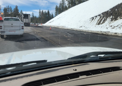
This has been going on for several years now. Seems to have started after they straightened out the curves on this reasonably mild pass between Susanville, and Mountain Meadows ( Westwood ) area. The thing that baffles me is, I track earthquakes in this/our area several times a day, and have never seen an earthquake, even the smallest micro-quake in that area, not even close to that pass. ~~~~~~~~~~~~~~~~~~~~~~~~~~~~~~~~~ Seismic Repairs Continue on Highway 36 Near Fredonyer Summit. If you’re driving on State Route 36 near Fredonyer Summit, be prepared for some delays—Caltrans and construction crews are working around the clock to fix earthquake-related damage to the road. Recent seismic activity has caused cracking and shifting pavement, making travel tricky, especially for low-clearance vehicles. To address the issue, crews from Caltrans District 2 and Tullis, Inc. are grinding and smoothing the road while also investigating long-term solutions to stabilize the area. What Drivers Need to Know Expect Delays: One-way traffic control is in place 24/7, and wait times could be up to 25 minutes. Slow Speeds: When a pilot car is guiding traffic, drivers must keep speeds under 15 MPH in areas where pavement is removed. Use Caution: Stop signs and signals will be in place, and all drivers should take it slow and stay alert in the work zone. Changing Conditions: Weather and ongoing slide activity could impact the construction schedule, so conditions may change without notice. If you’re traveling through the area, plan ahead, drive safely, and be patient—crews are working hard to make sure the road is safe for everyone. |
Responses:
[98840] [98839] [98842] [98836] [98838] [98837] [98835]
98840
From: eaamon, [DNS_Address]
Subject: Re: Could use a little help with this one
|
by the way that stretching was described in the BBC/PBS movie of Redfern, "the Making of a Continent." a 6 hour series. |
Responses:
None
98839
From: eaamon, [DNS_Address]
Subject: Re: Could use a little help with this one
|
my appraisal, it is similar to the spreading actions going on through Nevada. if you are familiar with that. land locked at the CA Grapevine/Fort Tejon area as it is pushing Northward is causing Nevada's land to sink in some areas. I think of Barstow/Mojave rte 58 and those dips in the 'Wheels' of Rock Hudson's testing the Mustang through the deep dips in the roadway. the Sierras and all being pushed Northwest ward. I just think it is all a precursor for the big one coming soon. who knows maybe in just a few days!? |
Responses:
[98842]
98842
From: jordan, [DNS_Address]
Subject: Re: Could use a little help with this one
|
Walker Lane |
Responses:
None
98836
From: jordna, [DNS_Address]
Subject: Re: Could use a little help with this one
URL: https://www.lassennews.com/seismic-repairs-continue-on-highway-36-near-fredonyer-summit
|
The project is grinding and smoothing pavement over various fault lines and conducting geological and survey investigations to best determine a more comprehensive, long-term fix for the area. 1. they are having landslide activity and are expeceting some quakes to hit area. 2. micro quakes are happening but they are not being detected by network, because no local seismographs or earthquake booms are not picked up. Small earthquakes often don't register on seismographs because they are too weak. However, the vibrations from these earthquakes can sometimes be heard as a boom or rumble. |
98838
From: Jeff/Lake Almanor,CA, [DNS_Address]
Subject: Re: Could use a little help with this one
|
Thanks Jordan. Lassen News is also one of our go-to news sources, since Plumas News closed up shop. Several areas alone hwy 36 on the east side of Fredonyer Summit, where all this activity is going on, are signs of exposed Ancient River rock along the road cuts. Since I'm an enthusiast of gold hunting, my research makes me confident that this is Auriferous rock from the Ancient Jura River. Many ancient rivers have tended to follow faults, via gravity. Which are alway changing from lifting and shifting. I suppose this rock/gravel may ack as a lubricant in the fault for now, But if things lock up, it could release a significant detectable quake. Thanks again to you and ryan also. |
Responses:
None
98837
From: jordan, [DNS_Address]
Subject: Re: Could use a little help with this one
| typo darn ipad |
Responses:
None
98835
From: ryan, [DNS_Address]
Subject: Re: Could use a little help with this one
| that is around the southern end of the volcanic subduction zone area, just south of lassen...may be related...inflation, etc... |
Responses:
None
[ Earthwatchers ] [ Main Menu ]