[ Earthwatchers ] [ Main Menu ]
98546
From: ao, [DNS_Address]
Subject: The current unrest, eruptions, at Kilauea..
|
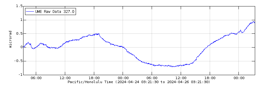
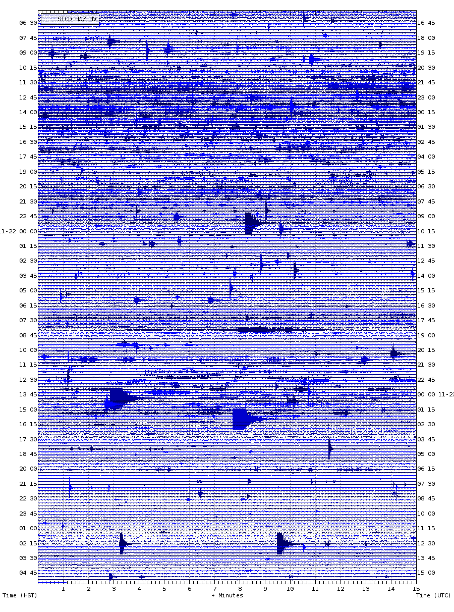
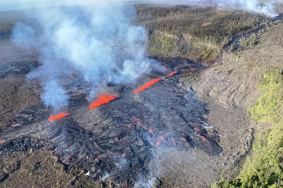
For those interested in the shenanigans of Kilauea.. As I have noted repeatedly Kilauea has been in a long period of reinflation after the eruption in 2018, and as it inflates the magma is finding and filling all the void spaces created with the last drawdown. One of the more complicated parts of the plumbing, the distribution system inside of the volcano, is how the magma gets from the summit magma chambers down into the East Rift Zone.. which seemingly comes from higher in the edifice’s system. As such as the mountain has expanded we have seen forays, intrusions and short lived eruptions, from the summit (all the magma that comes into the volcano appears to go through the ’summit’ system before it gets distributed to one or the other of its rift zones) into the Southwest earlier than what has been happening now where there are intrusions to the East. And all those have happened mostly with minimal consequences on the volcano’s surface.. Recently, in the last few days, there has been a series of intrusions, and some episodic short lived eruptions, in an area further to the east than before, and now almost within the landscape of Puu Oo. As such I am taking a moment to mark the activity with this post. As per my MO, here is the relevant datasets.. This is a webcam set up to observe the current activity. It is located onthe northern rim of Napau Crater looking to the southwest. And it presents a single still image that is refreshed every 10-15 minutes. To see the refresh here you have to reload the page.  This is the tilt signal for the last 48 hours measuring a point on the west side of the summit caldera.. and is faithful in measuring the accumulation and loss of magma in the summit magma chamber. It is a pretty simple correlation between inflation equals no eruption and deflation suggests an eruption. Of course in truth it’s way more nuanced than that but it’s a good general rule of thumb. From my experience of watching this signal since it was established more than 30 years ago my sense is 1 microradian (the measurement on the left side of the plot) equals 1 million cubic meters of magma.  And this is a seismic station is close proximity to the eruption that covers the same 48 hours of time as the tilt, where the tremor signal should be sympathetic to the rate of eruption, and tilt. Though the station is not as clean of atmospheric noise as would be ideal. 
|
Responses:
[98549]
98549

From: ryan, [DNS_Address]
Subject: Re: The current unrest, eruptions, at Kilauea..
URL: https://www.sfgate.com/hawaii/article/hiking-trail-nature-reserve-closed-hawaii-volcano-19777313.php
|
Hiking trail and nature reserve close in Hawaii amid volcano eruption By Amy Graff, Senior News EditorSep 19, 2024 This photo provided by the U.S. Geological Survey, captured during a Hawaiian Volcano Observatory helicopter flyover Tuesday, Sept. 17, 2024, shows the eruption in Kilauea’s middle East Rift Zone in Hawaii Volcanoes National Park, Hawaii. A. Ellis/USGS/AP On Wednesday, the recent eruption of Kilauea volcano shuttered a reserve and a trail on the Big Island of Hawaii. Kahaualea Natural Area Reserve and the Kahaualea Trail (aka the Captain’s Trail), which winds through the reserve, are now closed, officials said. The Hawaii Department of Land and Natural Resources said the reserve and the trail, located to the west of the volcano, will be closed for at least 90 days to protect visitors from potential toxic fumes and cracks in the ground. “Assuming people respect the trail closure, the primary hazard is the gas,” said David Phillips, deputy scientist-in-charge at the U.S. Geological Survey’s Hawaiian Volcano Observatory. “The emissions are primarily sulfur dioxide. [The eruption] is happening in our rainforest area, so there are trees burning, so you can get a mix of toxic fumes from the volcano and the burning of vegetation.” #Kilauea erupted briefly last night in a remote area west of Nāpau Crater on the middle East Rift Zone in Hawaiʻi Volcanoes National Park. Lava eruption started between 9:00-10:00 pm HST (Sep 15, 2024) & has ended. Sulfur dioxide continues to de-gas from vents. Vegetation burned. pic.twitter.com/i82iyJD5an — USGS Volcanoes🌋 (@USGSVolcanoes) September 16, 2024 After a period of seismic activity, Kilauea came to life on Sept. 15, when lava shot out from a fissure in a remote area of the middle East Rift Zone just west of Napau Crater in the national park, according to the Hawaiian Volcano Observatory. The volcano has continued to erupt, with lava spewing from fissures inside and near the crater, on and off. “It has gotten bigger, especially over the past day,” said Phillips. As of Thursday morning, Phillips said lava was covering over two-thirds of the crater in a 100-plus-acre area. This is the second eruption on Kilauea this year; one occurred on June 3 for about six to seven hours, Philips said. “A big difference is that was in a different part of Kilauea volcano,” he said “That eruption was southwest of the summit.” The ongoing eruption has not caused any road closures or evacuations. “There is no immediate threat to life or infrastructure,” USGS said. The 3.4-mile Captain’s Trail begins where Captain’s Drive dead-ends into the reserve near the small community of Pahoa. The trail takes you through the reserve, home to hardened lava flows and lush rainforest filled with native plants, such as ohia trees. “The area is rugged,” Ryan Aguilar, a spokesperson for the Department of Land and Natural Resources, said. “There are cracks and pits.” The department said in a news release that rescues have been made in this area by the Hawaii Fire Department but did not provide any information on when they occurred and the circumstances. “Individuals could be severely injured,” the agency said. People are being asked to stay out of the reserve. |
Responses:
None
[ Earthwatchers ] [ Main Menu ]