[ Earthwatchers ] [ Main Menu ]
95744
From: jordan, [DNS_Address]
Subject: 4.1 central california
URL: https://scedc.caltech.edu/recent/Quakes/nc73705146.html
|
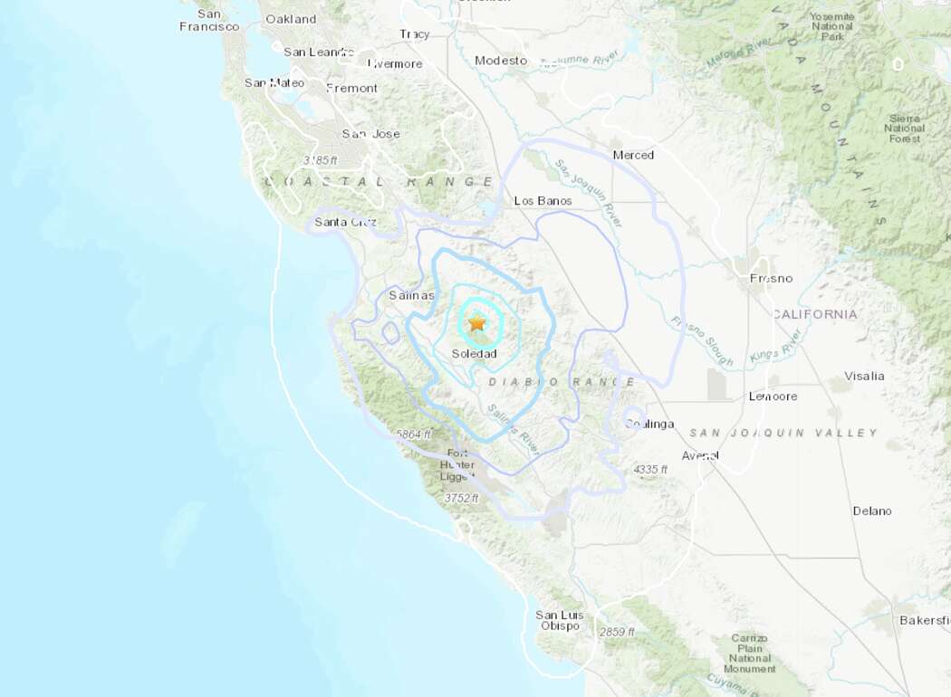
Version #5: This report supersedes any earlier reports of this event. This event has been reviewed by a seismologist. A light earthquake occurred at 1:51:30 PM (PDT) on Sunday, March 13, 2022. The magnitude 4.1 event occurred 22 km (14 miles) NE (34 degrees) of Soledad, CA. The hypocentral depth is 6 km ( 4 miles). Magnitude 4.1 - moment magnitude (Mw) Time Sunday, March 13, 2022 at 1:51:30 PM (PDT) Sunday, March 13, 2022 at 20:51:30 (UTC) Distance from Soledad, CA - 22 km (14 miles) NE (34 degrees) Gonzales, CA - 24 km (15 miles) ENE (69 degrees) Chualar, CA - 29 km (18 miles) E (86 degrees) Ridgemark, CA - 30 km (18 miles) SSE (148 degrees) Greenfield, CA - 30 km (19 miles) N (9 degrees) Coordinates 36 deg. 35.2 min. N (36.587N), 121 deg. 11.4 min. W (121.189W) Depth 6.16 km (3.8 miles) |
95747

From: ryan, [DNS_Address]
Subject: Re: 4.1 central california
|
3 More Quakes Follow 4.1 Temblor Near Soledad March 14, 2022 A 4.1 earthquake was followed by several more temblors in the region near Soledad, California on Sunday March 13, 2022. By Bay City News Three small earthquakes rumbled Sunday night in the same area where a 4.1 magnitude quake struck earlier that afternoon, according to the U.S. Geological Survey. The three smaller quakes happened just 22 minutes apart about 13.5 miles northeast of Soledad. The first one was 3.3 magnitude at 9:09 p.m., then a 2.8 magnitude at 9:31 p.m. and the last one seven seconds later at a 2.5 magnitude. The 4.1 magnitude temblor hit at 1:50 p.m. All four earthquakes occurred within a half-mile diameter in the Gabilan Range of mountains along the San Andreas Fault just east of State Route 25, also known as Airline Highway. There were no reports of injuries caused by any of the quakes. |
Responses:
None
95745
From: ryan, [DNS_Address]
Subject: Re: 4.1 central california
URL: http://earthboppin.net/talkshop/geology/messages/95732.html
| now this on is on the other end of the "extended" hayward faultline...pay attention... |
Responses:
[95759]
95759

From: ryan, [DNS_Address]
Subject: Re: 4.1 central california
URL: https://www.sfgate.com/bayarea/article/3-6-magnitude-earthquake-jolts-Bay-Area-17013841.php
|
and another on the southern stretch of the hayward faultline... 3.6 magnitude earthqake Fiona Lee, SFGATE March 19, 2022 The epicenter of the 3.6 magnitude quake was located near Corralitos, between Gilroy and Santa Cruz. The epicenter of the 3.6 magnitude quake was located near Corralitos, between Gilroy and Santa Cruz. USGS.gov A magnitude 3.6 earthquake gave a quick jolt to the Bay Area on Saturday morning at 10 a.m., the United States Geological Survey reported. The epicenter was located in Corralitos, between Gilroy and Santa Cruz, initial reports said. Preliminary reports designated the quake as magnitude 3.9; the USGS later downgraded it to magnitude 3.6. The depth of the quake was 13 km. There were no initial reports of damage or injuries. The quake was widely felt across the Bay Area, as well as the Central Coast and Valley. Reports of residents who felt the shake ranged from Marin to Monterey, and as far east as Los Banos, according to the USGS Shake Map. "A rumble then a hard jolt like a truck coming down the road," one Santa Cruz resident described on Twitter. As a precaution, Cal Fire's San Mateo - Santa Cruz (CZU) unit activated a procedure for its fire stations in Santa Cruz County to conduct damage assessments, if any. During the procedure, stations park the vehicles outside and conduct building damage assessments, the unit tweeted. Fire service vehicles in San Mateo County have been parked outside as a precaution following the #earthquake just north of Watsonville. https://t.co/8yJ06Fepgn pic.twitter.com/zGeMFw2IZN — CAL FIRE CZU (@CALFIRECZU) March 19, 2022 More information on this earthquake is available on the USGS event page. |
Responses:
None
[ Earthwatchers ] [ Main Menu ]